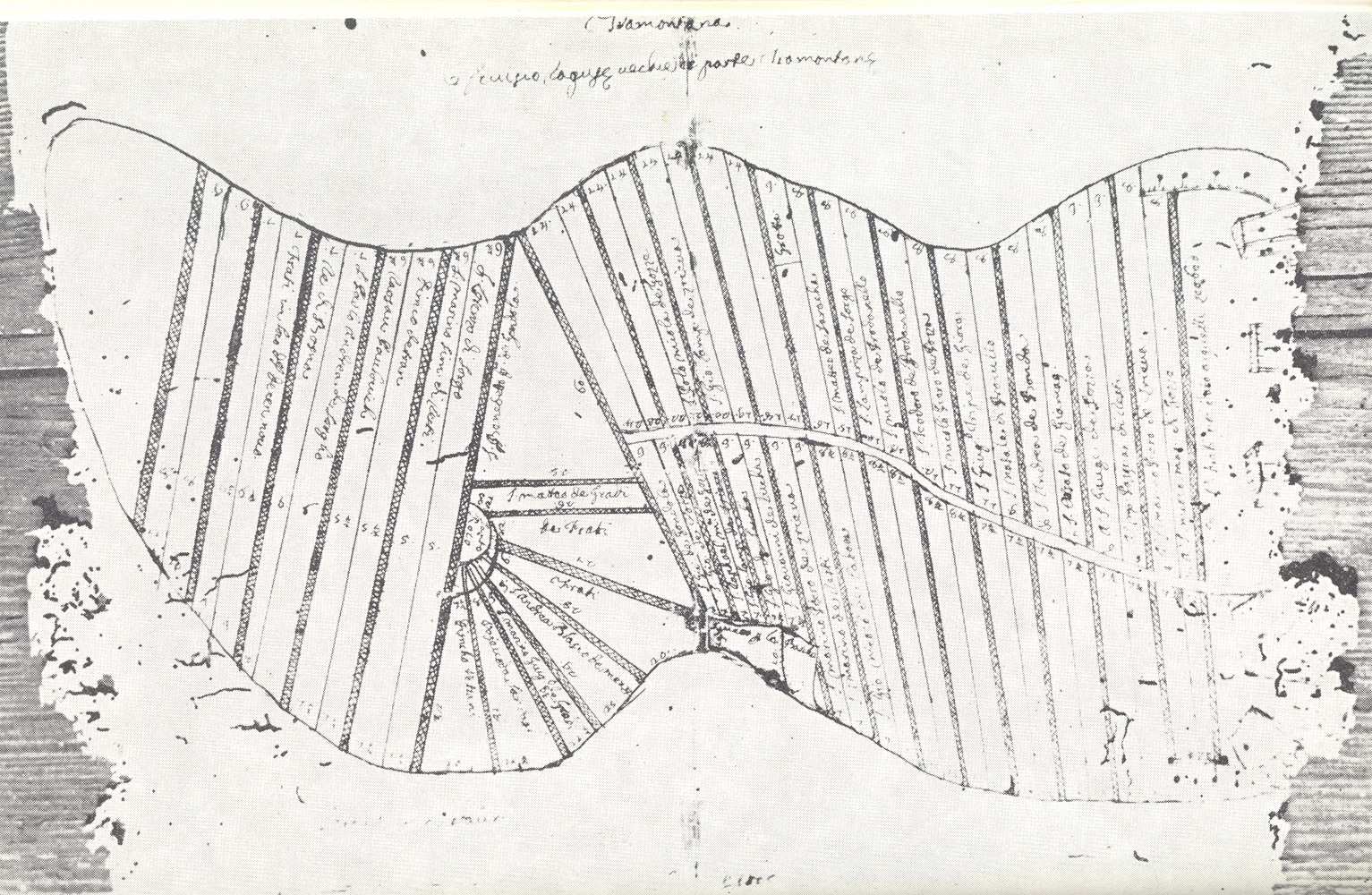
The Prijeko street is one of the oldest streets in the urban matrix of Cavtat. The curved line of the street that follows the spine of the peninsula is also drawn on the oldest map of the spatial division of the area in question dating back to the 16th century, which is kept in the Franciscan monastery in Dubrovnik. The map in question is in fact a copy of an architectural plan from the second half of the 15th century, on which parallel, longitudinal parcels of land were marked by the names of their respective owners. The aforementioned parcels were grouped in pairs; each pair was separated from the neighbouring parcels by lanes on the east and west side. The Prijeko street marks the sole departure from an otherwise regular architectural plan.
The planned construction of Cavtat was started after the Republic of Dubrovnik managed to purchase the Konavle region from Radosav Pavlović in 1426. Having established its rule over the area in 1466, the Republic of Dubrovnik determined the manner in which the land would be divided.
Franciscan monastery, Dubrovnik
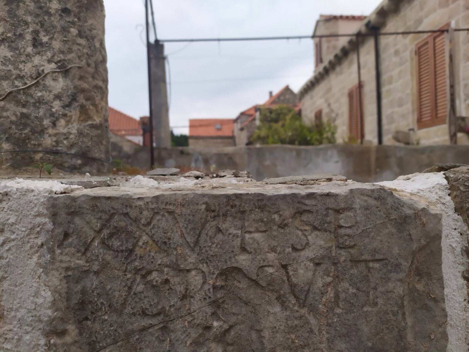
The new space allotment plan was based on a previously delineated ancient matrix. Therefore, the winding street now known as Prijeko is a rare transversal in the structure of streets mostly perpendicular to it. It was once the main street, i.e. a decumanus maximus, which connected the colony of Epidaurum with its ager. Parallel to it, there stretched a section of the water supply line. The water supply in question brought water to the town from the village of Vodovađa, 24 kilometres away. As noted by Baltazar Bogišić, a fragment of an ancient tombstone was found in the Prijeko street during the construction work on the excavation of a cistern. The aforementioned fragment can still be seen today in that street, built on the parapet terrace wall of the Lonza house.
Since the Republic of Dubrovnik intended Cavtat to serve as a safe haven for the population of Konavle, a defensive wall was built at the eastern end of the peninsula. Within the town, the longitudinal parcels were surrounded by high stone walls, which served as additional fortification in order to provide double security to the residents of Cavtat and Konavle.
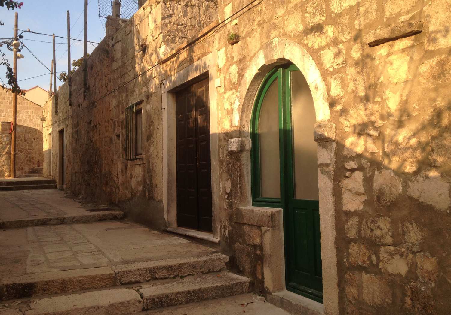
As Cavtat’s function of a safe haven was lost over time, the town began to transform its urban and social structure at the end of the 17th century. At that time, almost standardized single-storey houses were built along the northern side of the Prijeko street. Along the edge of the street there still stands a wall behind which there once were small courtyards (korte), and/or small ground-floor buildings housing either shops or craftsman’s workshops with roof terraces. Larger gardens were located in the backyard. The living spaces in this type of housing were rather simple – the kitchen was located in the attic or on the ground floor. The commercial character of the Prijeko street was one of its key features.
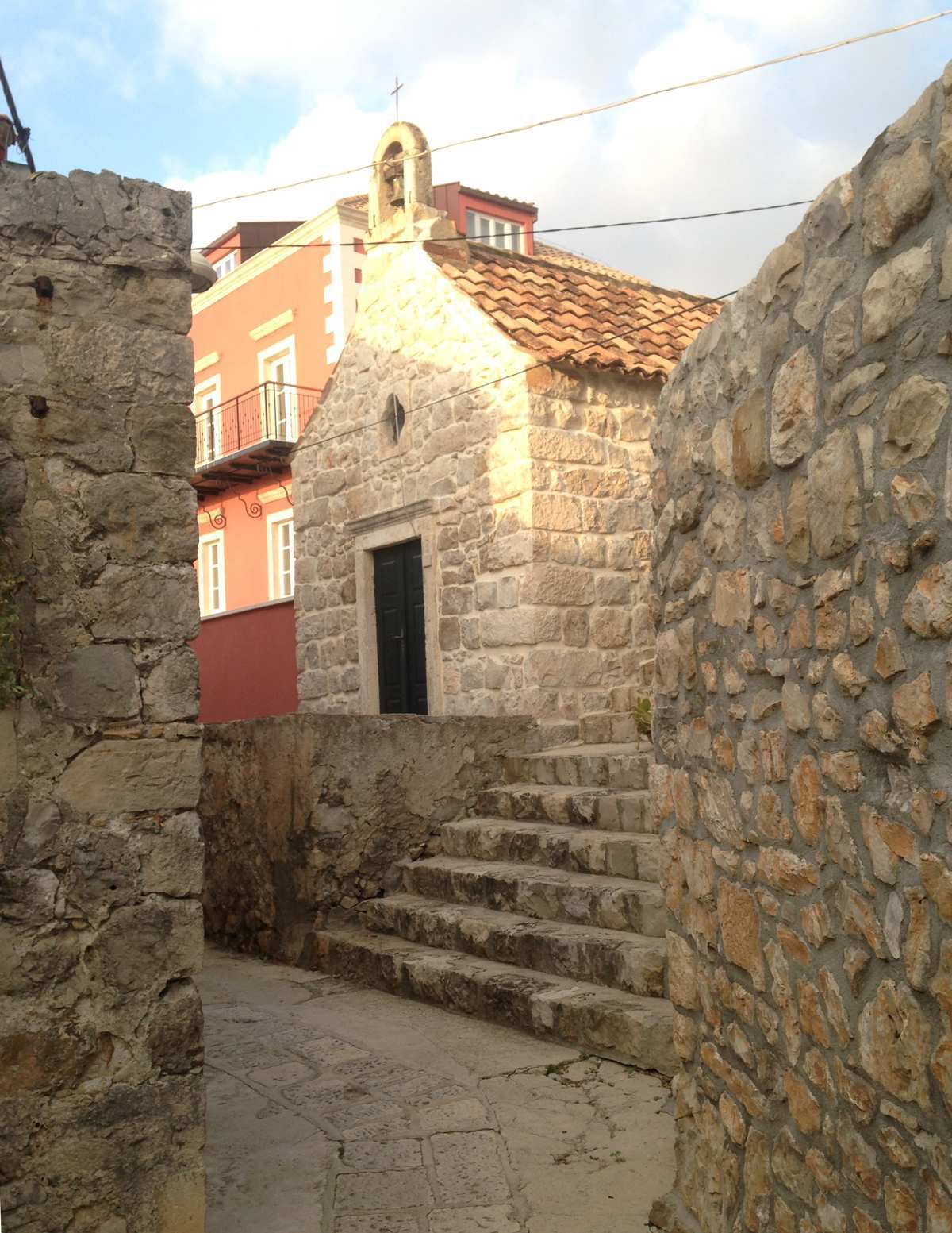
In addition to this type of residential architecture, there was also a more complex type of construction, a palace or a summer villa. Most of them were built in earlier periods and were built on the southern side of Prijeko. Besides some of the more representative buildings in the town, the northern side of the street also featured private chapels – the St Joseph Chapel and the St Trinity Chapel. The chapels are oriented north-south, rectangular in plan, each containing either a rosette or an oculus and a bell gable above the entrance portal.
Over the course of recent decades, the Prijeko street has unfortunately lost the liveliness and character it once possessed, while inadequate architectural adaptations of houses and gardens further degraded this harmonious space.